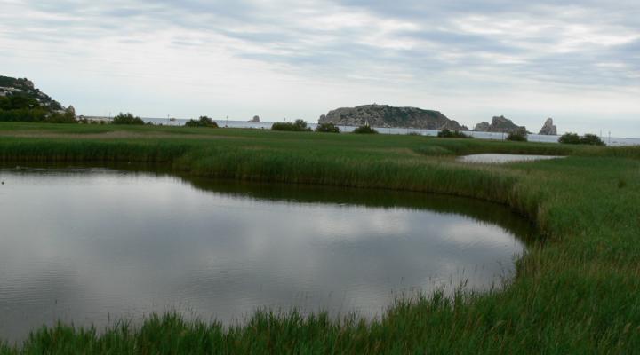
Ter Vell wetlands
This space is one of those fascinating, unique spots that distinguish a region and enrich its landscape. In the middle of the Costa Brava, a region subjected to strong urban pressure, this tiny natural gem shows the natural wealth of well-conserved coastal wetlands, with shore vegetation and a wide variety of fauna.
ALL THE SPACES IN THE NETWORKGeology
This property is located on the southern part of the Empordà Depression, a broad area located in northeast Catalonia. It is bordered on the north by the steep terrain of the eastern end of the Pyrenees, which sinks into Cap de Creus, and on the south by the terrain of the Prelitoral range. This depression corresponds to tectonic basins that originated, during the Neogen period, by normal faults that sink rocky blocks and at the same time they are filled with continental or marine sediments.
To the south of this zone, the ancient rocks (Palaeozoic) of Les Gavarres crop out, while to the north the carbonate rocks (Mesozoic) of El Montgrí massif thrust over the materials from the Tertiary. The Ter plain is primarily made of sediments from the terraces on the lower stretch of the river.
The Ter Vell preserve is the former mouth of the river before it was diverted and separated from L’Estartit. After the diversion project, the riverbed was cleared and the form of the riverbed was conserved until it was occupied by crop fields. Today the riverbed per se is no longer visible, but the mark of its old course can still be seen in the landscape through the shapes of the crop fields and the existence of the lagoon by the sea. It is fed with underground water which circulates, taking advantage of the old riverbed and the influx of sea water. On this last stretch, the sea encroaches upon the river, depositing sand, the product of winds which erode the narrow band of coastal dunes. In this way, the sea and the wind are overtaking the river as a consequence of man's action.
