Montserrat-Coll de Can Maçana
Located in the town of Bruc and within the Mountain of Montserrat Nature Park, this space occupies almost 7% of the nature park and is the main access point to the trails and rocky peaks in this lesser-known part of Montserrat, where the monoliths and vertical forms create a unique, awe-inspiring labyrinth.
ALL THE SPACES IN THE NETWORKGeology
Coll de Can Maçana is on the southern edge of the Ebro River valley near the Precoastal Mountain Range. This valley gradually filled with sediment during the Tertiary while the Alpine orogeny was building the Pyrenees to the north and the Precoastal Mountain Range to the south and southeast. This valley used to be filled by the sea, but sediments carried by the rivers and coming from the formation of the topography were deposited around it. Montserrat was the centre of an alluvia fan where hundreds of metres of coarse materials were deposited, which later became the conglomerate rock of Montserrat. These coarse sediments pass into the centre of the basin into fine sediments (clays, loams and layers of sandstone).
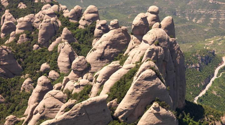
Montserrat mountain is not formed by tectonics but by the differential erosion between hard rocks (conglomerates) and softer rocks (clay and sandstone). Its characteristic shape is the result of the action of water on the conglomerate rock, which seeps into it through a thick layer of joints (fractures) which split the rocks of Montserrat.
In Coll de Can Maçana, the rocky outcroppings are made of clay and layers of sandstone and conglomerate rocks from the centre of the alluvial fan of Montserrat. If you move towards the centre of the massif (Serrat de la Portella or Agulles Region), you will find more solid conglomerate rocks with their characteristic shape of sharp peaks and deep crevices. The route leading to Coll de la Portella and the Vicenç Barbé refuge will allow you to enjoy and observe these rocks nestled in topographical features which stand in stark contrast to the flatter lands around you.
The entire Mountain of Montserrat is considered a Space of Geological Interest (geozone 224) by the Department of the Environment and Housing.
Space included in the GeoParc of Central Catalonia

