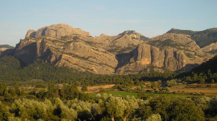
Port d'Arnes
Abrupt labyrinth of forest and rock around the wonderful gorge of the Straits of Arnes, one of the most beautiful places in the massif of Els Ports, the wildest mountains in southern Catalonia.
ALL THE SPACES IN THE NETWORKGeology
The Port of Arnes is located in the area of connection between the Prelitoral mountain range, of general direction NE-SO, and the Iberian one of direction NO-SE. The Pre-littoral and Iberian mountain ranges, although more modest, formed at the same time as the Pyrenees, during alpine orogenesis. Tectonic compression resulted in the Paleozoic and Mesozoic rocks slowly rising and overlapping northward over Tertiary materials in the Ebro Basin.
This space is divided into four units. The northernmost Unit (A) corresponds to a series of conglomerate rock terrains that belong to the Ebro basin. They are the result of sedimentation of alluvial fans of rivers that came from the south. When they erode, these conglomerates give high terrain, because they are tougher than the rocks that surround them, as is the case with Montsant or Montserrat. The morphologies observed here remind us of the mountains of Montserrat.
The rest of the units (B, C and D) are located south of the Prelitoral mountain range. The steep and abrupt terrains come from the overcrowding of Mesozoic tectonic units. These units are mainly composed of limestone with ochre and grey marsh and Jurassic and lower Cretaceous marshes. Within the uniformity of the landscape, some interspersed units, of Triassic red clay and sandstone, stand out due to their colour.
Due to its geological, heritage and landscape interest, part of this space joins the geozone 316 which is part of the inventory of Spaces of Geological Interest of the Department of the Environment of the Government of Catalonia.
